SDDCTEA develops and manages transportation infrastructure data in support of its mission to improve the global deployment ability of U.S. Armed Forces. The Agency executes its mission through its core functions of transportation and deployment engineering and analysis. As the figure below suggests, transportation infrastructure data is required to perform these functions, and, in turn, these functions produce additional data.
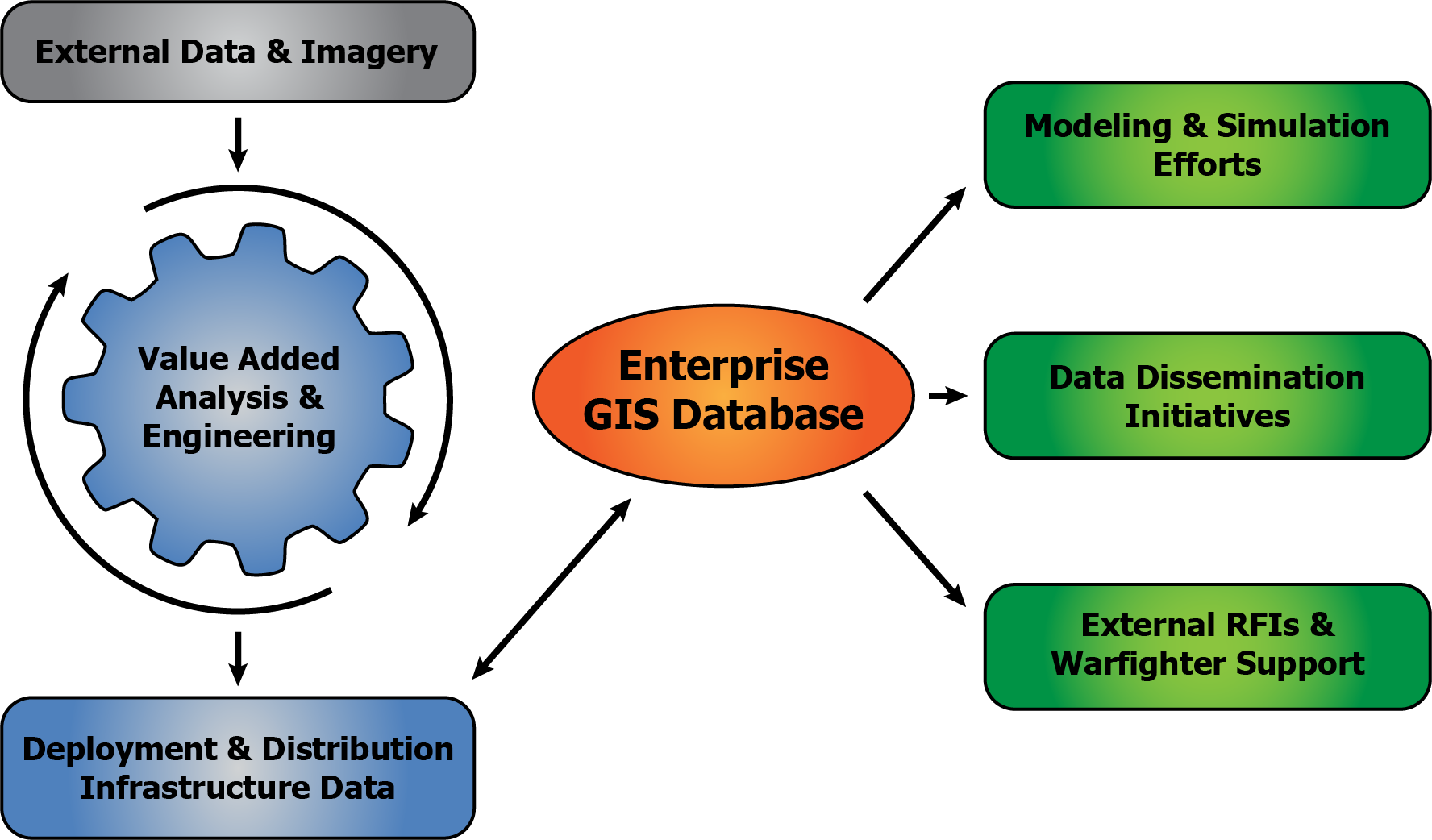
The Agency applies advanced information technology in the management of its transportation infrastructure data, such as the use of geographic information systems (GIS). This technology combines relational database capabilities with a digital geographic environment, resulting in a tool for creating spatially-oriented databases. SDDCTEA applies commercial off-the-shelf (COTS) GIS technology for creating and maintaining databases of military installations, militarily useful seaports, and modal networks (i.e., road, rail, waterways and pipelines). This supports downstream engineering and analysis, which often includes the use of modeling and simulation (M&S) tools which require this data.
Agency engineers and analysts pull information from a variety of sources before adding value through GIS to produce data suitable for supporting our engineering and analysis functions. SDDCTEA engineers and analysts add value to transportation infrastructure data sets by estimating the military load classification (MLC) of road bridges and the throughput capacities of roadways in terms of vehicles forward per day.
One significant source of data is imagery. SDDCTEA makes use of both commercial and government satellite imagery. The Agency's analysts provide imagery exploitation expertise for identifying and measuring infrastructure attributes relevant to deployment capability analysis. SDDCTEA also uses imagery as a "backdrop" within GIS for digitizing the spatial aspects of deployment-related features of installations and seaports.
SDDCTEA's transportation infrastructure data mission is in direct support of its engineering and analysis functions. However, to the extent this data may be beneficial to other organizations, we provide external access to the Agency's GIS-based transportation infrastructure data via the JDPAC/TEA GIS Gateway.